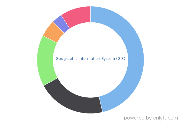
Geographic Information System (GIS) products
219,996 Companies
What is Geographic Information System (GIS)?
A geographic information system or geographical information system (GIS) is a system designed to capture, store, manipulate, analyze, manage, and present all types of spatial or geographical data. The term describes any information system that integrates, stores, edits, analyzes, shares, and displays geographic information. GIS applications are tools that allow users to create interactive queries (user-created searches), analyze spatial information, edit data in maps, and present the results of all these operations. Geographic information science is the science underlying geographic concepts, applications, and systems.
Market Share of Geographic Information System (GIS) products
At enlyft, we use sophisticated, patent-pending algorithms to track the use of various Geographic Information System (GIS) products and technologies. We track 26 products in the Geographic Information System (GIS) category, and have found 219,996 companies using these products.


Target customers using Geographic Information System (GIS) products to accomplish your sales and marketing goals.
| Product |
Install base
# of companies we found using this product |
Market Share |
|---|---|---|
| MapBox | 100,625 | 45% |
| ArcGIS | 43,905 | 19% |
| ESRI | 34,249 | 15% |
| QGIS | 12,903 | < 5% |
| MapInfo | 6,297 | < 5% |
| ArcGIS Pro | 4,847 | < 5% |
| ArcGIS Online | 4,674 | < 5% |
| Arc/View | 4,671 | < 5% |
| Blue Marble Global Mapper | 1,956 | < 5% |
| Arc/Info | 1,946 | < 5% |
| ArcIMS | 1,088 | < 5% |
| ERDAS IMAGINE | 831 | < 5% |
| Geocortex | 641 | < 5% |
| ArcGIS Platform | 420 | < 5% |
| Maptitude | 381 | < 5% |
| Geosoft | 160 | < 5% |
| ArcGIS Spatial Analyst | 118 | < 5% |
| MapMarker | 100 | < 5% |
| Apache Sedona | 50 | < 5% |
| Oracle Spatial and Graph | 35 | < 5% |
| Lepton Software | 22 | < 5% |
| Maptive | 20 | < 5% |
| Norkart | 19 | < 5% |
| Hexagon GeoMedia | 17 | < 5% |
| eSpatial | 11 | < 5% |
| Geocodio | 10 | < 5% |


